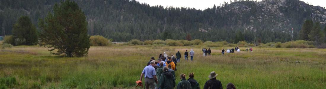
Watch our series of short videos on the importance of the
Sacramento-San Joaquin Delta, how it works as a water hub for
California and the challenges it is facing.
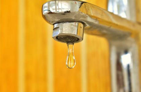
Some people in California and across the West struggle to access
safe, reliable and affordable water to meet their everyday needs
for drinking, cooking and sanitation.
There are many ways to support our nonprofit mission by donating
in someone’s honor or memory, becoming a regular contributor or
supporting specific projects.
As atmospheric rivers blasted across California this year, they
brought epic amounts of rain and snow follwing a three-year
drought.
Devastating and deadly floods hit parts of the state and now all
eyes are on the potential for more flooding, particularly in
the San Joaquin Valley as the record amount of snow in the
Sierras melts with warmer temperatures.
With anticipated sea level rise and other impacts of a changing
climate, flood management is increasingly critical in California.
Groundwater basins in California
and across the world are the source for much of the water that
grows our food. But many challenges come with groundwater:
Keeping use sustainable, nitrate contamination and impacts
from climate change.
The world’s top scientists, policymakers and experts will be
addressing these topics June 18-20 in San
Francisco at the
3ʳᵈ International Groundwater Conference Linking Science &
Policy, along with the latest advancements on
groundwater demand management, conjuctive use, managed aquifer
recharge, groundwater governance and emerging artificial
intelligence resources related to groundwater and agriculture.
Big
Day of Giving is nearly over but you still have
until midnight to support the Water Education Foundation’s tours,
workshops, publications and other programs with a donation to help us reach our
$15,000 fundraising goal - we are only
$6,405 away!
At the Foundation, we believe that education is as precious
as water. Your donations help us every day to teach K-12
educators how to bring water science into the classroom and to
empower future decision-makers through our professional
development programs.
Our portfolio of programs reach many people and in many
different ways:
Heavy rains this winter and spring sent torrential flows down
local creeks and rivers, and L.A. County managed to capture and
store a significant amount of that stormwater, officials say.
To be exact, they snared an estimated 295,000 acre-feet of
water since last October, or 96.3 billion gallons. That’s
enough water to supply about 2.4 million people a year — nearly
one-fourth of the county’s population. … The county,
working with the Los Angeles Department of Water and Power and
other agencies, was able to capture and store this amount of
water thanks in part to investments totaling more than $1
billion since 2001, Pestrella said. Some of the money has gone
toward raising dams and increasing the capacity of spreading
grounds, where water is sent into basins and then percolates
underground into aquifers.
A team of researchers has been hard at work in the Rocky
Mountains to solve a mystery. Snow is vanishing into thin air.
Now, for the first time, a new study explains how much is
getting lost, and when, exactly, it’s disappearing. Their
findings have to do with snow sublimation, a process that
happens when snow evaporates before it has a chance to melt.
Perhaps most critical in the new findings is the fact that most
snow evaporation happen s in the spring, after snow totals have
reached their peak. This could help water managers around the
West know when to make changes to the amount of water they take
from rivers and reservoirs.
In an effort to avoid the fate of their neighbors to the north,
Kern County water managers are putting the finishing touches on
a new groundwater plan they hope will stave off probation in
order to keep state bureaucrats from taking over local pumping.
The county’s 20 groundwater agency boards began approving final
changes to the plan, which is actually six identical plans,
last week in expectation of submitting them to the state Water
Resources Control Board by May 28. The goal is to stay out of
probation, which is where the Tulare Lake subbasin ended up
after a hearing before the Water Board on April 16. Tulare Lake
covers almost all of Kings County. Now, under probation, most
Kings County growers will have to register their wells at $300
each and report extractions starting July 15.
A few weeks ago, the Australian Bureau of Meteorology declared
that the Pacific Ocean is no longer in an El Niño state and has
returned to “neutral.” American scientists at the National
Oceanic and Atmospheric Administration have been more hesitant,
but they estimate that there is an 85% chance that the Pacific
will enter a neutral state in the next two months and a 60%
chance that a La Niña event will begin by August. … As
an El Niño phase begins, [the trade winds] winds weaken, so
that warm sea surface temperatures move east toward South
America. This can cause climatic shifts across the globe:
landslides in Peru, drought in Australia, fish die-offs in the
eastern Pacific and more frequent atmospheric rivers in
Southern California. These changing weather patterns also
weaken the trade winds further, leading to more warm water off
the coast of South America, which in turn weakens the winds,
and so on.
As the date of reckoning for excessive groundwater pumping in
Tulare County grows closer, lobbying by water managers and
growers has ramped up. The Friant Water Authority, desperate to
protect its newly rebuilt – yet still sinking –
Friant-Kern Canal, has beseeched the Water Resources Control
Board to get involved. Specifically, it has asked board members
to look into how the Eastern Tule Groundwater Sustainability
Agency (GSA) has, or has not, curbed over pumping that affects
the canal. Meanwhile, the Eastern Tule groundwater agency has
been doing a bit of its own lobbying. It recently hosted all
five members of the Water Board on three separate tours of the
region, including the canal. Because the tours were staggered,
there wasn’t a quorum of board members, which meant they
weren’t automatically open to the public.
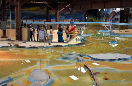
Operated by the U.S. Army Corps of Engineers, the
Bay Model is a giant hydraulic replica of San Francisco
Bay and the Sacramento-San Joaquin
Delta. It is housed in a converted World II-era
warehouse in Sausalito near San Francisco.
Hundreds of gallons of water are pumped through the
three-dimensional, 1.5-acre model to simulate a tidal ebb
and flow lasting 14 minutes.
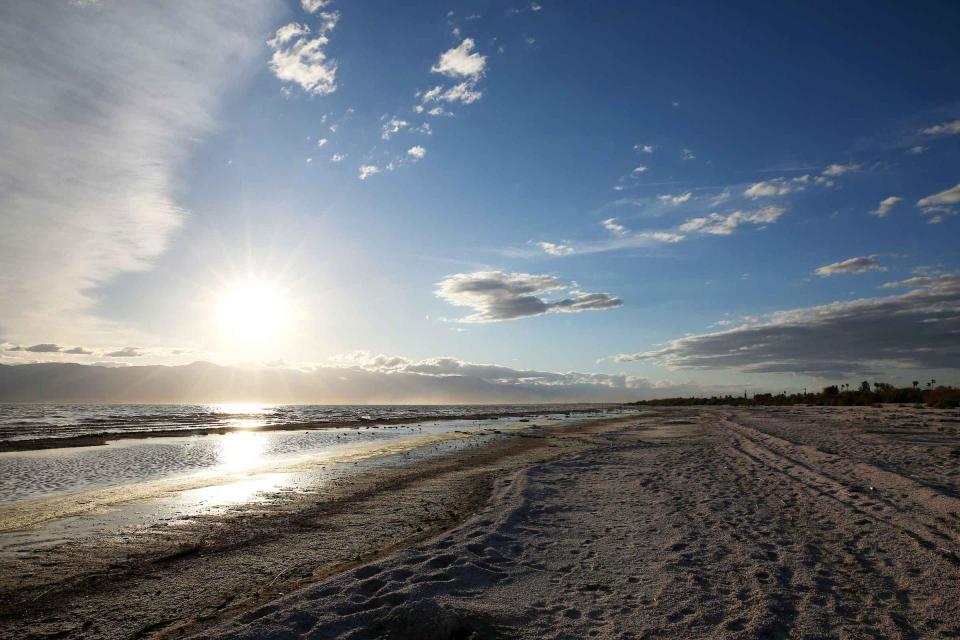
As part of the historic Colorado
River Delta, the Salton Sea regularly filled and dried for
thousands of years due to its elevation of 237 feet below
sea level.
The most recent version of the Salton Sea was formed in 1905 when
the Colorado River broke
through a series of dikes and flooded the seabed for two years,
creating California’s largest inland body of water. The
Salton Sea, which is saltier than the Pacific Ocean, includes 130
miles of shoreline and is larger than Lake Tahoe.